![]()
![]()
![]()
|
|
|
|
1st March 2002 - 7.7 Miles & 3100ft Ascent
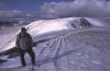
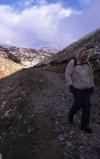
Originally planned for the previous day, todays walk was put back 24 hours due to bad weather. Chris & myself had arranged to meet Richard who was driving up from Preston, at the Kirkstone Pass car park at 9.30am. From here, we would drive to the car park at Hartsop and leave a car there, driving back to the Kirkstone Pass car park in the second car. Being above the snow line at the Kirkstone Pass, everything was white with a strong cold wind blowing from the North over the pass. It was obviously going to be even colder over the tops, and so I opted for a base T, fleece shirt, fleece jacket and my waterproof jacket along with gloves, hat and long johns. I was determined not to feel the cold all day. It would also be a good test of my gear and its breathability when all worn together.
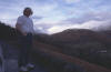
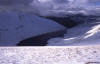
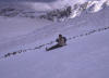
We left the car park and crossed the stile behind the Kirkstone Pass Inn. Englands second highest pub was an obvious place to start and finish this walk. Although we couldn't see any paths or tracks, I knew from studying the maps previously that the path followed along the side of the wall ahead upto St. Ravens Edge. In fact, todays navigation even with snow underfoot should be straight forward, as our route would be accompanied by 3 walls all the way. The only exception to this would be the crossing between Thornthwaite Crag & High Street. We continued to follow the wall, through the snow drifts and passed the Mark Atkinson memorial to the cairn on Caudale Moor / Stoney Cove Pike. The views stretched for miles as the cloud stayed high. Views to Morcombe Bay, Yoke, Ill Bell & Froswick in the South, Coniston Old Man and Red Screes in the South-West & St. Sunday Crag & Helvellyn to the North-West.
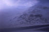
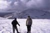
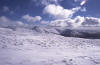
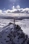
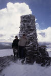
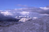
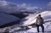
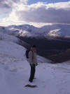
What was to follow would be the scramble of the day. Still following the wall, a steep descent to Threshthwaite Mouth, a col which is situated at the heads of Trout Beck to the South & Pasture Beck to the North, and approx 200m below and between Stoney Cove Pike & Thornthwaite Crag. After reaching the bottom, a short break was had before we began the steep snowy scramble upto the 15ft high Thornthwaite Beacon. Kicking steps in the lying snow and ice, this would have been a good time to have that ice axe handy - which I didn't have. It would not have been a good idea to loose your footing at this time on this scramble. Fortunately, we made the summit. From here the walk would be relatively easy going as most of the ascent was now over. Leaving the wall, we headed off across the obvious route towards High Street where another wall would be followed over the summit. On High Street, the crags fall away into Hayswater on the West and the views to the East stretch over Hawswater to the M6 and beyond to the North Pennines. To the North, Blencathra and to the South the Kentmere valley.
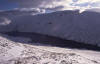
Passing the trig on the summit, this one is part of the Ordnance Survey National GPS Network as the little plate on it indicates. We dropped down to the Riggindale Straits where a right turn would take you onto Rampsgill Head & Kidsty Pike. Our route was straight ahead and up a little ascent to the cairn on The Knott.
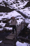
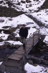
All that now remained was a 65m descent from the cairn to a third wall which would take us down to the outlet for Hayswater. Here, a short break to remove some excess clothing and have a drink before following the track back to Hartsop and our earlier parked car. A quick drive back up the Kirkstone Pass to collect the other car and the day would be over.
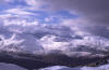
A word of caution. If this route is undertaken in similar winter conditions, I would advise the use of an ice axe on the scramble into and out of Threshthwaite Mouth. The conditions on our scramble were on the verge of dangerous due to the fact that none of us had an ice axe with us. Indeed, a group of three who had started their ascent ahead of us decided to turn back down having only made it a third of the way up. Also, the steep gradient and subsequent drop into Trout Beck is enough to give even the slightest vertigo sufferer a shock. TIME TAKEN : 6 Hours |