![]()
![]()
![]()
![]()
|
|
|
|
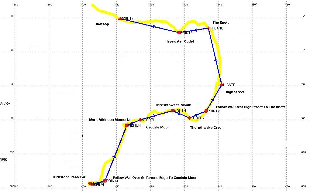
Before setting out on our planned walk, I programmed my Magellan 315 GPS with some specific waypoints, which are indicated as red markers on the map below. I then chose specific waypoints, namely the summits of Caudale Moor, Thornthwaite Crag, High Street & The Knott, added a couple of others for the Kirkstone Pass, Mark Atkinson Memorial, Threshthwaite Mouth and the Hayswater outlet to make my route as indicated by the blue line.
The yellow line indicates the actual tracklog data downloaded from my GPS. The data is downloaded into my GPS Utility software which produces the above map. This data is overlayed onto a scanned Ordnance Survey or Harveys map in GPS Utility giving a true route map, but for copyright reasons cannot be shown here. |